GPS Map Camera

Explore Powerful GPS Map Camera Features for Accurate Photo Documentation

GeoSnap combines powerful GPS Camera App Features with an intuitive interface to help you capture photos with GPS location, coordinates, date, time, and custom map stamps. Organize, customize, and share your documentation effortlessly.

Powerful GPS Map Camera Features Built for Accurate Field Documentation

Personalize Your Location Templates

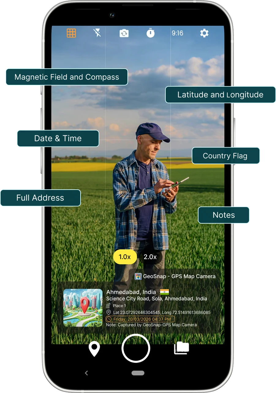
Customize how location details appear on every photo with flexible Location Templates. GeoSnap lets you display GPS location, coordinates, date, time, address, and map information in a clean, professional layout. Whether you're documenting inspections, construction projects, surveys, or travel, our GPS Map Camera Features help you create accurate and reliable GPS Photo Documentation.

  • Multiple customizations for location template
  • Custom fonts and colors
  • Display GPS coordinates and address
  • Easy one-tap customization
  • Professional photo layouts
GPS Map Camera
GPS Map Camera

Style your Template

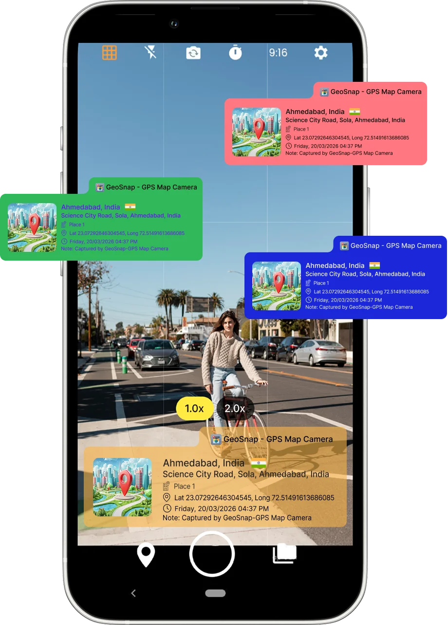
Create GPS photo stamps that match your style with flexible location template and design settings. Our GPS Camera App with Date and Time lets you customize text color, background color, and template size while choosing how your location information is displayed. Make every GPS photo stamp clear, professional, and uniquely yours.

  • Customize text color
  • Change background color
  • Adjust location template size
  • Easy location template settings
  • One-tap style customization
  • Professional GPS photo stamps
  • Perfect for travel, fieldwork & documentation

Share Instantly, Anywhere

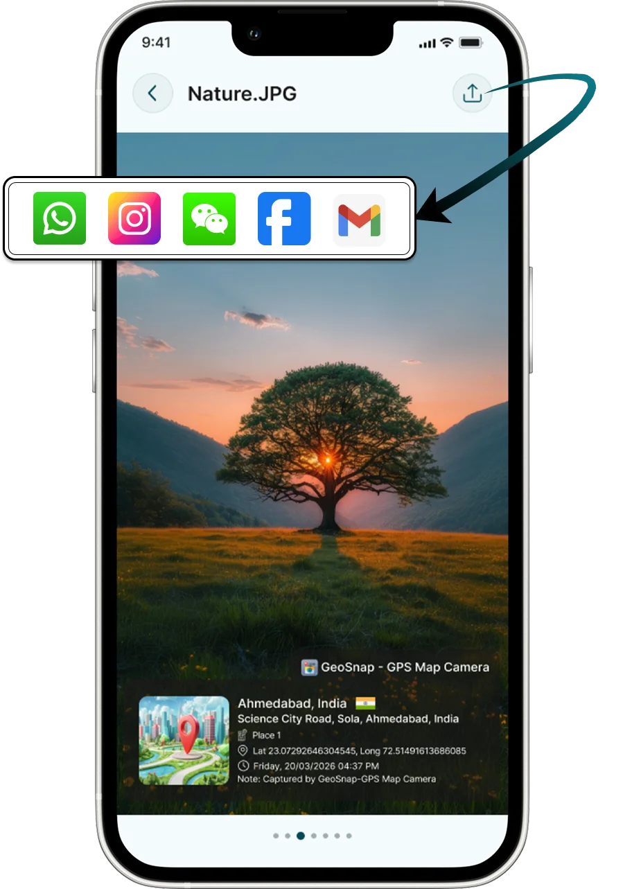
Share your GPS Photo Camera images with your team, clients, or stakeholders in just a few taps. GeoSnap makes it easy to send location-stamped photos through your favorite communication and cloud storage apps without losing important GPS information.

  • One-tap sharing
  • Email & messaging support
  • Social media sharing
  • Cloud storage integration
  • High-quality image export
GPS Map Camera
GPS Map Camera

Organize Photos With Smart Albums

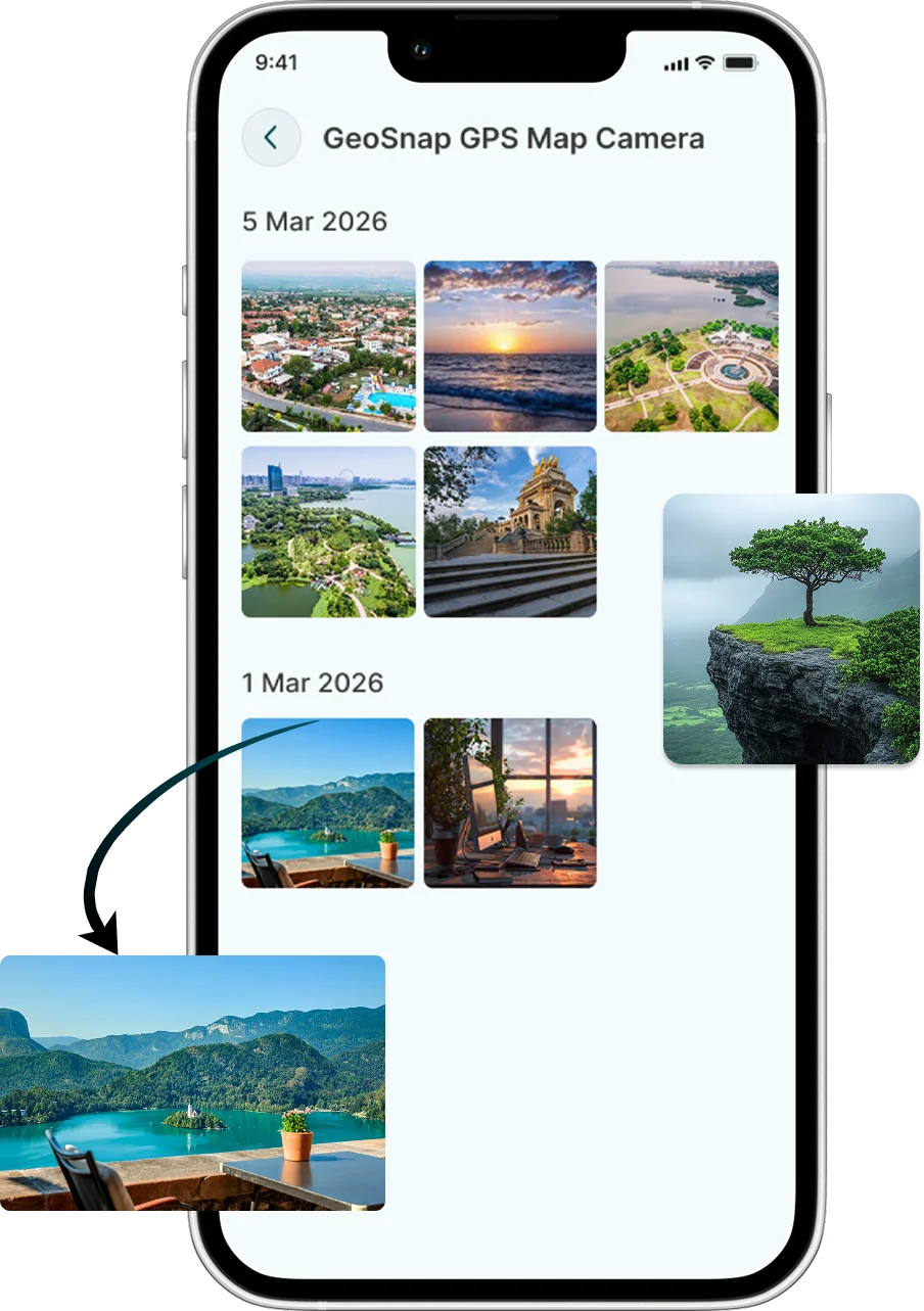
Never lose track of your work. Organize your GPS Photo Documentation into smart albums based on projects, inspections, locations, or dates. Easily access your photos whenever you need them.

  • Unlimited albums
  • Project-based organization
  • Quick photo search
  • Secure photo storage
  • Easy photo management

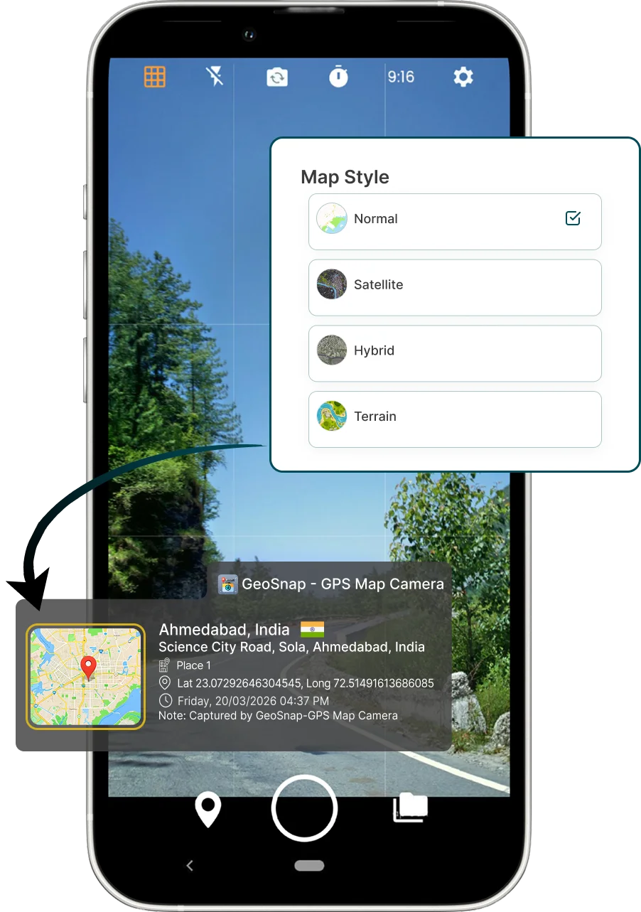
Choose Your Preferred Map Style

Customize your GPS Map Camera by selecting the map view that best fits your workflow. Display location information using Standard, Satellite, Terrain, or Hybrid maps to make every photo more informative.

  • Standard map view
  • Satellite View
  • Terrain View
  • Hybrid Map
  • Clear location display
GPS Map Camera
GPS Map Camera

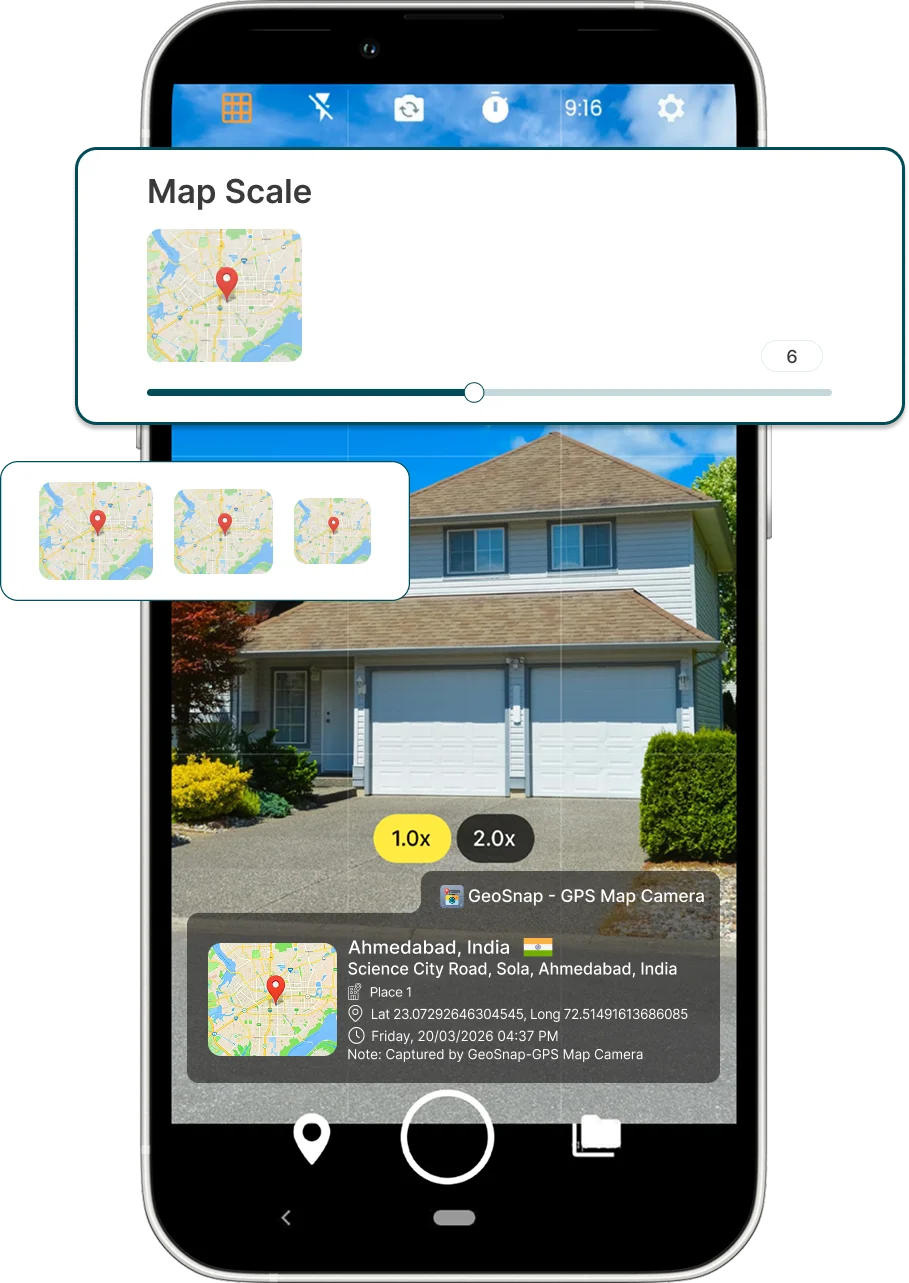
Adjust Map Size With Ease

GeoSnap gives you complete control over how your map appears. Resize the map overlay to highlight important location details while keeping your photos clean, balanced, and professional.

  • Adjustable Map Size
  • Smooth resizing
  • Better photo visibility
  • Flexible layout options
  • Optimized for every screen

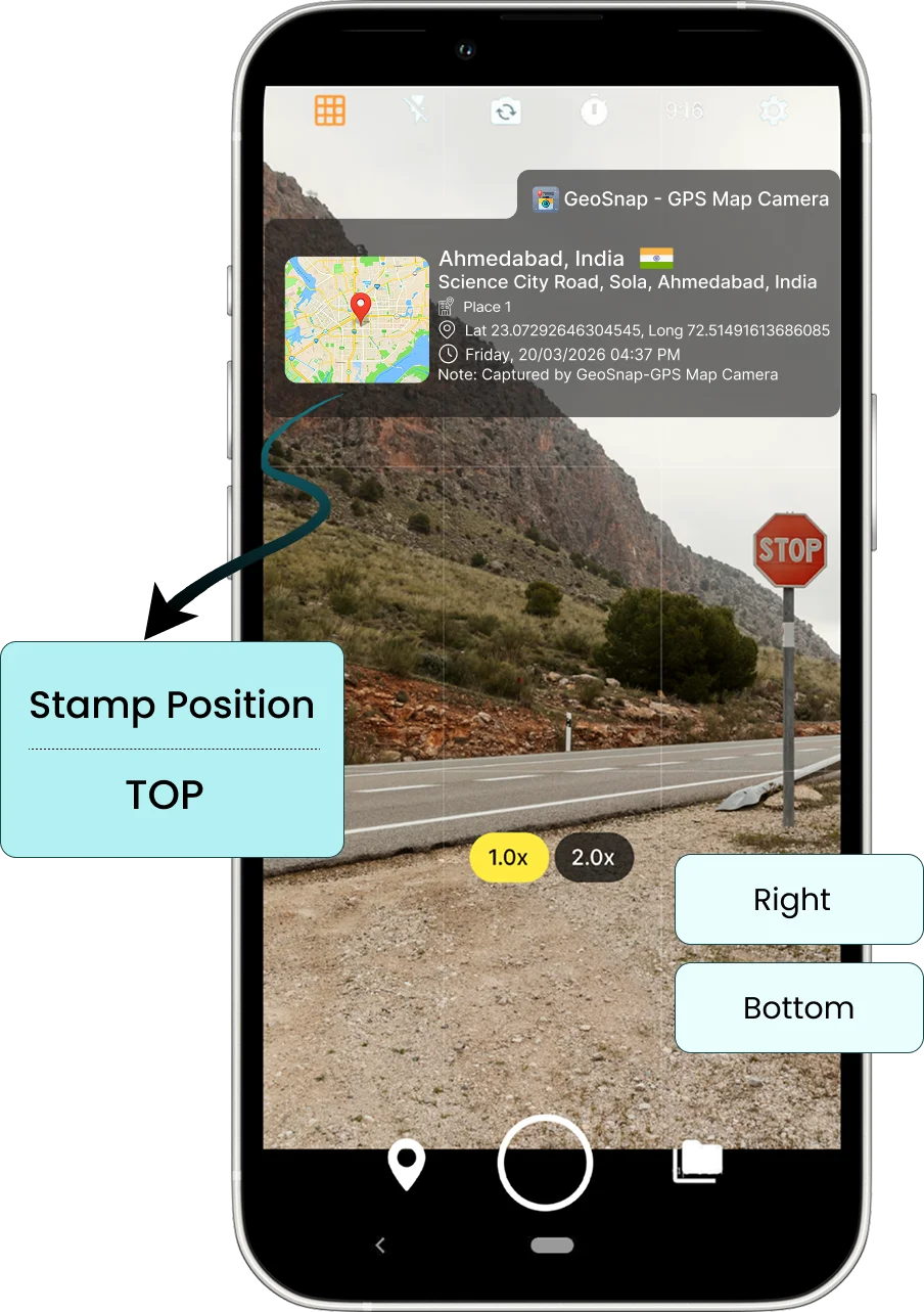
Place The Stamp Where You Want

Position your Location Stamp Camera overlay exactly where it works best. Move the GPS stamp to any corner of the image to ensure important details remain visible while maintaining a professional layout.

  • Move stamp anywhere
  • Top or bottom placement
  • Left or right alignment
  • Adjustable margins
  • Personalized layouts
GPS Map Camera

Frequently Asked Questions

GPS Map Camera Features help you capture photos with GPS location, coordinates, date, time, and customizable map stamps. These features make it easy to create accurate and professional photo documentation for inspections, fieldwork, construction, travel, and more.
GeoSnap automatically detects your device's GPS location and adds accurate latitude, longitude, address, and map information to every photo. This ensures reliable and location-verified photo documentation.
Yes. You can personalize your GPS Photo Stamp by choosing different layouts, fonts, colors, map styles, and the information you want to display, including GPS coordinates, date, time, and address.
Absolutely. GeoSnap includes a GPS Camera with Date and Time feature that automatically adds accurate timestamps to every photo. You can also choose from multiple date and time formats to match your documentation needs.
Yes. GeoSnap lets you choose from multiple map styles, including Standard, Satellite, Terrain, and Hybrid views. You can also resize and reposition the map overlay to create a clean and professional photo layout.

What Our Users Say

"GeoSnap has transformed how we document site inspections. Our clients and government reviewers now accept our photo evidence without question — the tamper-proof stamps give everyone confidence."

Rajesh Kumar
Civil Engineer, Delhi PWD

"As a real estate broker, I share property photos with clients abroad. GeoSnap stamps give them the confidence to trust what they're seeing. My conversion rate improved significantly after using it."

Priya Mehta
Real Estate Broker, Mumbai

"We use GeoSnap for our environmental field surveys across remote tribal zones. Offline GPS capture is a lifesaver. Reports are now automatically organized with location-stamped evidence. Outstanding tool."

Anand Sharma
Field Officer, MoEFCC

"I'm a solo traveler and GeoSnap is my favorite app. Every photo gets tagged with the exact place — I no longer need to write notes about where I was. My travel blog is so much richer now!"

Sneha Nair
Travel Blogger, Kerala