Trusted by 50,000+ Professionals

GeoSnap GPS Camera App for Real Estate Brokers

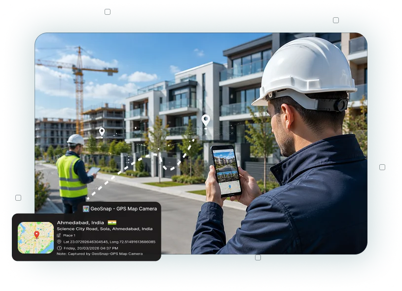
Buying, selling, renting, and inspecting properties requires accurate visual records. Whether you're conducting site visits, verifying property conditions, documenting new listings, or sharing updates with clients, GPS Camera App for Real Estate Brokers helps capture every property photo with verified location and time details. GeoSnap simplifies property documentation by automatically adding GPS, date, time, address, latitude, longitude, and map information to every image, making records more reliable and easier to manage.

GPS Map Camera

Why GeoSnap App for Real Estate Brokers?

Real estate professionals visit multiple properties every day, often handling site inspections, client meetings, and property verification across different locations. GPS Camera for Real Estate ensures every image includes trusted location and timestamp information, helping brokers maintain organized property records while improving transparency with buyers, sellers, and property owners.

Accurate GPS Location Tracking

Verified Property Location

Capture every property image with GPS coordinates, address, latitude, longitude, and map details to create reliable location-based documentation for every visit.

Automatic Date and Time Recording

Automatic Date & Time Records

The Timestamp Camera for Real Estate automatically records when each property photo is taken, making it easier to track inspections, listings, and client visits.

Organized Property Documentation

Organized Property Documentation

Use the Real Estate Photo Documentation App to maintain structured records of residential, commercial, and rental properties without relying on manual notes.

Reliable Offline Photo Capture

Reliable Offline Photo Capture

Never miss important property documentation due to poor network coverage. Capture and save photos with complete location details, then sync them when internet access is available.

Custom Property Information

Custom Property Information

Add listing IDs, project names, client references, broker details, or inspection notes directly to every image using customizable photo stamps.

Built-in Map Verification

Built-in Map Verification

The Location Stamp Camera for Property Visits displays the exact property location on every photo, making site verification simple for clients and internal teams.

High-Resolution Property Images

High-Resolution Property Images

Capture professional-quality photos that clearly showcase property conditions while preserving accurate GPS and timestamp information.

Faster Reporting & Client Updates

Faster Reporting & Client Updates

The Real Estate Documentation App helps brokers quickly organize and share verified property records with clients, agencies, and developers.

Common Use Cases For Real Estate

Property Site Visits

Property Site Visits

Use the Real Estate Site Visit App to document residential, commercial, and under-construction properties with verified location details.

Property Inspections

Property Inspections

The Property Inspection Camera App helps record structural conditions, amenities, maintenance work, and property status during inspections.

Property Verification

Property Verification

Capture Geo-Tagged Property Photos to verify property location before listing, purchasing, leasing, or completing documentation.

New Property Listings

New Property Listings

Create professional property records using the GPS Photo App for Realtors, ensuring every listing includes authentic location-based photo evidence.

Construction Progress Monitoring

Construction Progress Monitoring

Track construction milestones and renovation work with accurate photo records captured from the project site.

Rental Property Documentation

Rental Property Documentation

Record move-in, move-out, and maintenance conditions with Geo-Tagged Property Images to maintain transparent rental documentation.

Land & Plot Surveys

Land & Plot Surveys

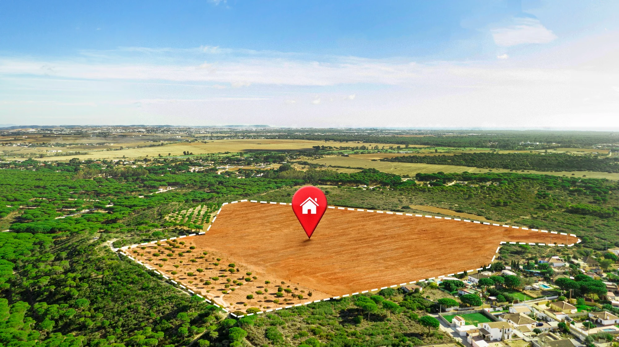
Use the Property Survey Camera App to document open plots, agricultural land, and development sites with accurate GPS information.

Property Handover Records

Property Handover Records

Capture verified photos during property possession and final handover to create dependable documentation for buyers and sellers.

Ready to Improve Property Documentation with GeoSnap App

Whether you're visiting client properties, verifying locations, conducting inspections, or creating new listings, GeoSnap helps you document every property with trusted GPS and time information. Accurate photo records improve communication, simplify documentation, and build greater confidence throughout the real estate process.

Capture every property visit with confidence using GeoSnap.

Why Real Estate Brokers Choose GeoSnap App

Managing multiple property visits can quickly become challenging without proper documentation. GeoSnap automatically records GPS location, address, date, time, latitude, longitude, and map details for every property image. This allows brokers to spend less time organizing photos and more time serving clients while maintaining reliable records for every transaction.

  • Verify every property visit with GPS location
  • Create professional property documentation
  • Reduce manual record-keeping
  • Improve transparency with buyers and sellers
  • Simplify property inspection reporting
  • Maintain organized listing records
  • Capture reliable evidence for property verification
  • Save time during site visits and follow-ups
Staff Love GeoSnap
            Field Documentation

Frequently Asked Questions

A GPS Camera App for Real Estate Brokers automatically adds GPS location, date, time, address, latitude, longitude, and map information to every property photo. It helps create reliable documentation for property visits, inspections, listings, and client records.
The GPS Camera for Property Inspection captures location-stamped photos that verify where and when inspections were completed. This improves reporting accuracy and provides trustworthy visual records.
Geo-Tagged Property Photos provide proof of property location and visit timing. They improve transparency, reduce documentation errors, and help brokers maintain accurate records for clients and agencies.
Yes. The Property Verification App helps brokers capture authenticated property images with GPS location and timestamps, making ownership verification, site confirmation, and documentation more reliable.
GeoSnap is ideal for real estate brokers, real estate agents, property consultants, builders, developers, channel partners, leasing professionals, property managers, housing societies, land surveyors, and real estate inspection teams.
Yes. The GPS Location Camera for Property Photos is suitable for apartments, villas, office spaces, retail shops, warehouses, industrial properties, construction projects, land parcels, and commercial buildings, helping professionals maintain accurate documentation for every property type.

What Our Users Say

"GeoSnap has transformed how we document site inspections. Our clients and government reviewers now accept our photo evidence without question — the tamper-proof stamps give everyone confidence."

Rajesh Kumar
Civil Engineer, Delhi PWD

"As a real estate broker, I share property photos with clients abroad. GeoSnap stamps give them the confidence to trust what they're seeing. My conversion rate improved significantly after using it."

Priya Mehta
Real Estate Broker, Mumbai

"We use GeoSnap for our environmental field surveys across remote tribal zones. Offline GPS capture is a lifesaver. Reports are now automatically organized with location-stamped evidence. Outstanding tool."

Anand Sharma
Field Officer, MoEFCC

"I'm a solo traveler and GeoSnap is my favorite app. Every photo gets tagged with the exact place — I no longer need to write notes about where I was. My travel blog is so much richer now!"

Sneha Nair
Travel Blogger, Kerala